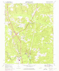
1969 Map of Ruther Glen
USGS Topo · Published 1975About this map
Ruther Glen and the surrounding Caroline County countryside are depicted here during a period of transition as Interstate 95 began to redefine the local landscape. The map centers on the historical crossroads of Carmel Church and the railroad stop at Ruther Glen, where the St Margarets Ch stands. While modern infrastructure like a Pipeline and new developments like Caroline Pines appear, the map remains anchored by older rural identifiers such as McBryant Corner, Peatross, and Signboard.
Find a feature on this map
49 named features on this map. Tap any name to fly to it.
Don’t see what you’re looking for? This feature index may not catch every label — zoom into the map to look around manually.
Map Details
Editions of this 1969 Ruther Glen Map
4 editions found
Other maps of this area

1887 · Spottsylvania
USGS Topo · 1:125,000

1889 · Fredericksburg
USGS Topo · 1:125,000

1890 · Goochland
USGS Topo · 1:125,000

1892 · Fredericksburg
USGS Topo · 1:125,000

1892 · Spottsylvania
USGS Topo · 1:125,000

1892 · Goochland
USGS Topo · 1:125,000

1894 · Fredericksburg
USGS Topo · 1:125,000

1918 · Doswell
USGS Topo · 1:62,500

1942 · Bowling Green
USGS Topo · 1:31,680

1942 · Woodford
USGS Topo · 1:31,680