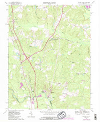
1969 Map of Ruther Glen
USGS Topo · Published 1985About this map
Ruther Glen and Carmel Church anchor this 1960s landscape, which centers on the busy corridor of the Richmond Fredericksburg and Potomac railroad. A preserved Civil War Fort near Fox Bridge along the North Anna River provides a tangible link to the area's 19th-century military history, while an Old Railroad Grade north of Chandler Crossing marks an earlier transportation alignment. The map reflects a rural economy defined by water and crossroads, from the extensive swamp systems like Rafe Swamp and Millpond Swamp to small communities like Signboard, Bagdad, and McBryant Corner. Prominent religious and community landmarks such as St Margarets Ch and Jericho Ch are visible alongside water features like Colemans Millpond and Lake De Jarnette. The terrain is characterized by numerous small runs and creeks, including Polecat Creek and Reedy Creek, flowing toward the Mattaponi River in the northeast.
Find a feature on this map
47 named features on this map. Tap any name to fly to it.
Don’t see what you’re looking for? This feature index may not catch every label — zoom into the map to look around manually.
Map Details
Editions of this 1969 Ruther Glen Map
4 editions found
Other maps of this area

1887 · Spottsylvania
USGS Topo · 1:125,000

1889 · Fredericksburg
USGS Topo · 1:125,000

1890 · Goochland
USGS Topo · 1:125,000

1892 · Fredericksburg
USGS Topo · 1:125,000

1892 · Spottsylvania
USGS Topo · 1:125,000

1892 · Goochland
USGS Topo · 1:125,000

1894 · Fredericksburg
USGS Topo · 1:125,000

1918 · Doswell
USGS Topo · 1:62,500

1942 · Bowling Green
USGS Topo · 1:31,680

1942 · Woodford
USGS Topo · 1:31,680