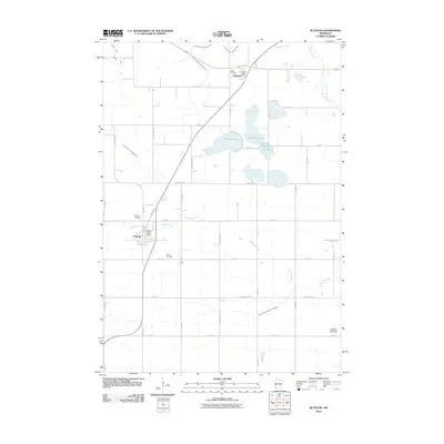
2010 Map of Ruthton
USGS Topo · Published 2010About this map
Ruthton and Florence anchor this agricultural landscape in Pipestone County, where the grid of rural roads meets the winding path of the Redwood River. The area is defined by its water management and glacial geology, featuring numerous drainage projects like Judicial Ditch Number Twelve and County Ditch Number Sixteen, alongside natural features such as West Twin Lake and Mitchell Slough. Genealogists will find significant local history in the presence of Opdal Cemetery, Ruthton Cemetery, and Peace Cemetery. The layout of the settlements remains centered around their respective postal hubs, the Ruthton Post Office and Florence Post Office, reflecting the enduring structure of these small Minnesota communities. Evidence of the changing environment is visible at the Ivadelle Lakebed, providing a clear look at the region's hydrological transitions over the years.
Find a feature on this map
43 named features on this map. Tap any name to fly to it.
Don’t see what you’re looking for? This feature index may not catch every label — zoom into the map to look around manually.
Map Details
Editions of this 2010 Ruthton Map
This is the sole edition of this map. No revisions or reprints were ever made.
Other maps of this area

1953 · Watertown
USGS Topo · 1:250,000

1953 · New Ulm
USGS Topo · 1:250,000

1957 · New Ulm
USGS Topo · 1:250,000

1958 · New Ulm
USGS Topo · 1:250,000

1958 · Watertown
USGS Topo · 1:250,000

1963 · Dead Coon Lake
USGS Topo · 1:24,000

1963 · Russell
USGS Topo · 1:24,000

1963 · Tyler
USGS Topo · 1:24,000

1967 · New Ulm
USGS Topo · 1:250,000
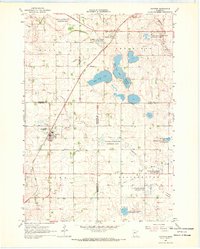
1967 · Ruthton
USGS Topo · 1:24,000