
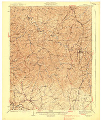
1939 Map of Sadieville
USGS Topo · Published 1939About this map
Sadieville and Stamping Ground anchor this 1930s survey of the Kentucky Bluegrass region, where the winding course of Eagle Creek carves a deep valley through the northern landscape. The Southern Railway runs north-to-south through the eastern corridor, following the terrain near Rogers Gap and serving rural hubs like Hinton. This era shows a high density of small community structures, particularly local schoolhouses such as Hammond Sch, Stonewall Sch, and Yates Sch, which were often the social center for dispersed farmsteads.
Find a feature on this map
79 named features on this map. Tap any name to fly to it.
Don’t see what you’re looking for? This feature index may not catch every label — zoom into the map to look around manually.
Map Details
Editions of this 1939 Sadieville Map
2 editions found
Other maps of this area

1906 · Lockport
USGS Topo · 1:48,000

1906 · Georgetown
USGS Topo · 1:62,500

1908 · Lockport
USGS Topo · 1:62,500

1908 · Georgetown
USGS Topo · 1:62,500

1922 · Frankfort
USGS Topo · 1:48,000

1924 · Frankfort
USGS Topo · 1:62,500

1927 · Lexington
USGS Topo · 1:48,000

1929 · Cynthiana
USGS Topo · 1:48,000

1929 · Lexington
USGS Topo · 1:62,500

1930 · Falmouth
USGS Topo · 1:48,000