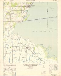
1947 Map of Safety Harbor
USGS Topo · Published 1952About this map
Safety Harbor stands as a primary focal point at the northern edge of Old Tampa Bay, established along the shoreline where Mullet Cr and Alligator Cr enter the bay. This mid-century survey captures the region's mid-century transition, with the massive Pinellas Army Airfield occupying a significant portion of the landscape south of Highpoint. The infrastructure of the era is clearly defined by the Davis Causeway spanning the bay toward Hillsborough County, complete with a recorded Toll House at its western approach. Inland, the Seaboard Air Line railroad cuts through the citrus groves and small settlements like Coachman and Bayview. The southern portion of the sheet reveals the complex hydrology of the Florida coast, featuring the Cross Bayou Canal and the marshy expanses of Grossy Bog, illustrating the early efforts to manage the wetlands for development and military use.
Find a feature on this map
40 named features on this map. Tap any name to fly to it.
Don’t see what you’re looking for? This feature index may not catch every label — zoom into the map to look around manually.
Map Details
Editions of this 1947 Safety Harbor Map
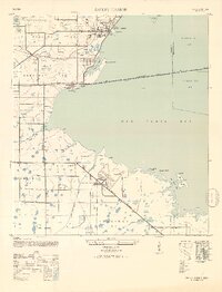
2 editions found
Other maps of this area

1921 · Sand Key
USGS Topo · 1:62,500

1921 · St Petersburg
USGS Topo · 1:62,500

1943 · St Petersburg
USGS Topo · 1:31,680

1943 · Gandy Bridge
USGS Topo · 1:31,680

1943 · Bay Pines
USGS Topo · 1:31,680

1943 · Safety Harbor
USGS Topo · 1:31,680

1943 · Dunedin
USGS Topo · 1:31,680

1943 · Port Tampa
USGS Topo · 1:31,680

1943 · Clearwater
USGS Topo · 1:24,000

1943 · Oldsmar
USGS Topo · 1:24,000