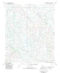
1955 Map of Sagavanirktok C-1
USGS Topo · Published 1985About this map
Kavik River and Juniper Creek carve through this North Slope landscape, defining the hydrology of a region where seasonal transit was essential. Based on 1955 aerial photography and field annotation, the map documents a sparse but deliberate network of transportation, most notably the Winter Trail which provided critical passage across the frozen tundra. A small cluster of Cabins situated near the confluence of local drainages suggests a point of temporary shelter or a base for early resource exploration in this remote portion of the Alaskan interior. The reliance on Trail networks and seasonal waterways highlights the challenges of movement across the permafrost and hills before more permanent infrastructure reached this part of the borough.
Find a feature on this map
5 named features on this map. Tap any name to fly to it.
Don’t see what you’re looking for? This feature index may not catch every label — zoom into the map to look around manually.
Map Details
Editions of this 1955 Sagavanirktok C-1 Map
2 editions found
Other maps of this area

1951 · Sagavanirktok D-5
USGS Topo · 1:250,000

1951 · Mt. Michelson
USGS Topo · 1:250,000

1955 · Mount Michelson C-5
USGS Topo · 1:63,360

1955 · Mount Michelson D-5
USGS Topo · 1:63,360
1955 · Sagavanirktok D-2
USGS Topo · 1:63,360
1955 · Sagavanirktok C-1
USGS Topo · 1:63,360
1955 · Sagavanirktok D-1
USGS Topo · 1:63,360

1956 · Mt. Michelson
USGS Topo · 1:250,000

1956 · Sagavanirktok
USGS Topo · 1:250,000

1958 · Sagavanirktok
USGS Topo · 1:250,000