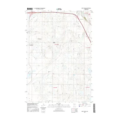
2016 Map of Saint Augusta
USGS Topo · Published 2016About this map
Saint Augusta and the neighboring settlement of Luxemburg anchor this mid-2010s landscape south of St. Cloud. The area is defined by a dense network of water bodies and tributaries, with the Mississippi River carving through the northeastern corner along the Sherburne County line. This survey shows a transitional landscape where residential expansion meets traditional rural layouts, marked by established community landmarks such as Saint Wendelin Cem and Saint Mary Cem. The terrain is pocketed with numerous lakes, including Beaver Lake, Mund Lake, and Hulbert Lake, while drainage is provided by several waterways like Johnson Creek and Plum Creek. The road system is dominated by county corridors such as County Highway 136 and County Road 74, illustrating the infrastructure connecting these historic Stearns County communities.
Find a feature on this map
56 named features on this map. Tap any name to fly to it.
Don’t see what you’re looking for? This feature index may not catch every label — zoom into the map to look around manually.
Map Details
Editions of this 2016 Saint Augusta Map
This is the sole edition of this map. No revisions or reprints were ever made.
Other maps of this area

1950 · St. Cloud
USGS Topo · 1:62,500

1951 · Annandale
USGS Topo · 1:62,500

1953 · Saint Cloud
USGS Topo · 1:250,000

1957 · Saint Cloud
USGS Topo · 1:250,000

1958 · Saint Cloud
USGS Topo · 1:250,000

1965 · St Joseph
USGS Topo · 1:24,000

1967 · Rockville
USGS Topo · 1:24,000

1967 · Kimball
USGS Topo · 1:24,000
1974 · Cable
USGS Topo · 1:24,000
1974 · St Augusta
USGS Topo · 1:24,000