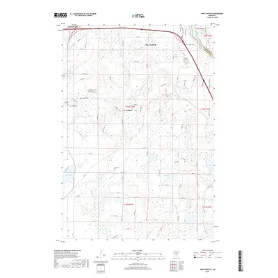
2019 Map of Saint Augusta
USGS Topo · Published 2019About this map
The Mississippi River carves the northeastern corner of this landscape, separating the developing outskirts of St. Cloud from the rural expanse of Stearns County. This modern survey reflects the growth of satellite communities like St. Augusta and Luxemburg, where residential subdivisions such as Garden Hills Ln meet traditional agricultural sections. Genealogists can locate several historic burial grounds including Saint Mary Help of Christians Cem, Saint Wendelin Cem, and the more isolated Gethsemane Cem located south of the main settlements.
Find a feature on this map
68 named features on this map. Tap any name to fly to it.
Don’t see what you’re looking for? This feature index may not catch every label — zoom into the map to look around manually.
Map Details
Editions of this 2019 Saint Augusta Map
This is the sole edition of this map. No revisions or reprints were ever made.
Other maps of this area

1950 · St. Cloud
USGS Topo · 1:62,500

1951 · Annandale
USGS Topo · 1:62,500

1953 · Saint Cloud
USGS Topo · 1:250,000

1957 · Saint Cloud
USGS Topo · 1:250,000

1958 · Saint Cloud
USGS Topo · 1:250,000

1965 · St Joseph
USGS Topo · 1:24,000

1967 · Rockville
USGS Topo · 1:24,000

1967 · Kimball
USGS Topo · 1:24,000
1974 · Cable
USGS Topo · 1:24,000
1974 · St Augusta
USGS Topo · 1:24,000