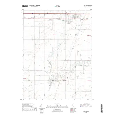
2018 Map of Saint Joseph
USGS Topo · Published 2018About this map
St. Joseph and Sidney anchor this section of Champaign County, where the landscape is defined by the winding course of the Salt Fork and a dense network of sectional roads. The map captures a quintessential Midwestern agricultural pattern, with small settlements like Mayview, Fulls, and Glover spaced along transport corridors. Genealogists will find significant value in the numerous burial grounds scattered across the townships, including Mount Hope Cem, Patterson Cem, and the Old Huss Cem. The presence of small aviation sites such as Busboom RLA Airport and Routh Airport indicates the continued importance of private flight in this rural region. The drainage patterns of Rush Br and Veazel Br illustrate the natural hydrology that local farmers have worked around for generations, while the grid of numbered county roads like Co RD 1200 N demonstrates the systematic organization of the Illinois prairie.
Find a feature on this map
56 named features on this map. Tap any name to fly to it.
Don’t see what you’re looking for? This feature index may not catch every label — zoom into the map to look around manually.
Map Details
Editions of this 2018 Saint Joseph Map
This is the sole edition of this map. No revisions or reprints were ever made.
Other maps of this area

1906 · Urbana
USGS Topo · 1:62,500

1931 · Fithian
USGS Topo · 1:48,000

1943 · Fithian
USGS Topo · 1:62,500

1953 · Danville
USGS Topo · 1:250,000

1953 · Indianapolis
USGS Topo · 1:250,000

1955 · Danville
USGS Topo · 1:250,000

1956 · Danville
USGS Topo · 1:250,000

1956 · Indianapolis
USGS Topo · 1:250,000

1956 · Newman
USGS Topo · 1:62,500

1956 · Villa Grove
USGS Topo · 1:62,500