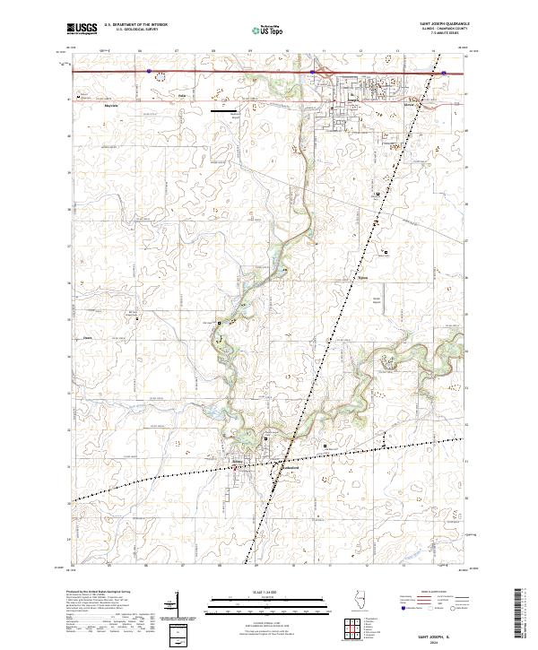
2024 Map of Saint Joseph
USGS Topo · Published 2024About this map
The Salt Fork river winds through the heart of this East Central Illinois landscape, anchoring a network of small settlements and rural crossroads. The town of St. Joseph sits at a major junction in the north, while Sidney occupies the southern reaches of the river valley. The surrounding agricultural land is dotted with markers of early pioneer history, specifically an unusually high density of family and community burial grounds such as Old Bliss Cem and Mount Hope Cem.
Find a feature on this map
78 named features on this map. Tap any name to fly to it.
Don’t see what you’re looking for? This feature index may not catch every label — zoom into the map to look around manually.
Map Details
Editions of this 2024 Saint Joseph Map
This is the sole edition of this map. No revisions or reprints were ever made.
Other maps of this area

1906 · Urbana
USGS Topo · 1:62,500

1931 · Fithian
USGS Topo · 1:48,000

1943 · Fithian
USGS Topo · 1:62,500

1953 · Danville
USGS Topo · 1:250,000

1953 · Indianapolis
USGS Topo · 1:250,000

1955 · Danville
USGS Topo · 1:250,000

1956 · Danville
USGS Topo · 1:250,000

1956 · Indianapolis
USGS Topo · 1:250,000

1956 · Newman
USGS Topo · 1:62,500

1956 · Villa Grove
USGS Topo · 1:62,500