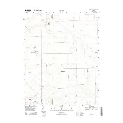
2015 Map of Saint Libory
USGS Topo · Published 2015About this map
The agricultural landscape of ST. Clair Co and Washington Co is defined by a network of rural settlements and winding tributaries. The village of Saint Libory serves as a northern anchor, while Darmstadt and the smaller community of Biddleborn dot the central plains. These settlements are connected by a grid of roads often named for local families and landmarks, such as Dintelmann Church Rd and Lichenbrock School Rd, reflecting the deep-rooted community history of this Illinois region.
Find a feature on this map
66 named features on this map. Tap any name to fly to it.
Don’t see what you’re looking for? This feature index may not catch every label — zoom into the map to look around manually.
Map Details
Editions of this 2015 Saint Libory Map
This is the sole edition of this map. No revisions or reprints were ever made.
Other maps of this area

1910 · Okawville
USGS Topo · 1:62,500

1912 · New Athens
USGS Topo · 1:62,500

1912 · Baldwin
USGS Topo · 1:62,500

1914 · Baldwin
USGS Topo · 1:62,500

1914 · Coulterville
USGS Topo · 1:62,500

1917 · Coulterville
USGS Topo · 1:62,500

1940 · Okawville
USGS Topo · 1:62,500

1942 · Baldwin
USGS Topo · 1:62,500
1954 · Mascoutah
USGS Topo · 1:24,000
1954 · New Athens East
USGS Topo · 1:24,000