
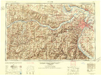
1949 Map of Saint Louis
USGS Topo · Published 1949About this map
The St Louis metropolitan area serves as the anchor of this mid-century survey, revealing a landscape defined by the confluence of the Missouri River and the Mississippi River. The post-war urban footprint is clearly visible, extending through established inner suburbs like University City, Kirkwood, and Webster Groves. Industrial and transportation hubs dominate the riverfronts, while the western and southern reaches transition into the Ozark Plateau and the St Francois Mountains.
Find a feature on this map
342 named features on this map. Tap any name to fly to it.
Don’t see what you’re looking for? This feature index may not catch every label — zoom into the map to look around manually.
Map Details
Editions of this 1949 Saint Louis Map
2 editions found
Other maps of this area

1886 · Jefferson City
USGS Topo · 1:125,000

1888 · Tuscumbia
USGS Topo · 1:125,000

1888 · St. Louis
USGS Topo · 1:62,500

1890 · Louisiana
USGS Topo · 1:125,000

1890 · Mexico
USGS Topo · 1:125,000

1890 · Moberly
USGS Topo · 1:125,000

1890 · Hermann
USGS Topo · 1:125,000

1890 · Fulton
USGS Topo · 1:125,000

1894 · Tuscumbia
USGS Topo · 1:125,000

1894 · Jefferson City
USGS Topo · 1:125,000