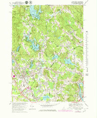
1968 Map of Salem Depot
USGS Topo · Published 1979About this map
Island Pond and the Arlington Mill Reservoir dominate the northern landscape of this Rockingham County study, illustrating the intensive management of New Hampshire's water resources for local industry and recreation. The area around Salem Depot and Salem reflects a period of significant growth, with the Boston and Maine railroad corridor facilitating development through Cluffs Crossing and Millville. A distinct cluster of summer colonies like Chases Grove and Conleys Grove suggests the region's enduring appeal as a seasonal destination.
Find a feature on this map
104 named features on this map. Tap any name to fly to it.
Don’t see what you’re looking for? This feature index may not catch every label — zoom into the map to look around manually.
Map Details
Editions of this 1968 Salem Depot Map
4 editions found
Other maps of this area

1886 · Lawrence
USGS Topo · 1:62,500

1886 · Lowell
USGS Topo · 1:62,500

1888 · Haverhill
USGS Topo · 1:62,500

1888 · Lawrence
USGS Topo · 1:62,500

1890 · Haverhill
USGS Topo · 1:62,500

1893 · Lowell
USGS Topo · 1:62,500

1893 · Lawrence
USGS Topo · 1:62,500

1893 · Haverhill
USGS Topo · 1:62,500

1905 · Manchester
USGS Topo · 1:62,500

1918 · Lowell
USGS Topo · 1:62,500