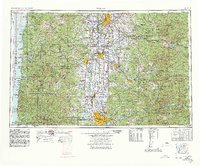
1960 Map of Salem
USGS Topo · Published 1978About this map
The Willamette Valley serves as the geographic heart of this mid-century survey, flanked by the Coast Range to the west and the towering peaks of the Cascade Range to the east. By 1960, the corridor between Salem and Eugene shows a well-developed network of transportation and water management, anchored by the Southern Pacific and Oregon Electric railroads. Major hydroelectric and flood control projects are evident in the presence of Detroit Lake, Foster Reservoir, and Fern Ridge Lake, which reshaped the hydrology of the Santiam River and McKenzie River systems. Along the Pacific shoreline, the map details the early development of coastal communities like Newport, Depoe Bay, and Lincoln City, alongside protected lands such as Siuslaw National Forest and the Heceta Head Lighthouse State Park. From the high timber of Mount Jefferson to the agricultural reaches of Corvallis and Albany, the map captures the transition from a resource-driven frontier to a settled regional economy.
Find a feature on this map
98 named features on this map. Tap any name to fly to it.
Don’t see what you’re looking for? This feature index may not catch every label — zoom into the map to look around manually.
Map Details
Editions of this 1960 Salem Map
2 editions found

Other maps of this area

1909 · Harrisburg
USGS Topo · 1:31,680

1909 · Rowland
USGS Topo · 1:31,680

1909 · Elmira
USGS Topo · 1:62,500

1910 · Eugene
USGS Topo · 1:62,500

1911 · Brownsville
USGS Topo · 1:31,680

1911 · Lebanon
USGS Topo · 1:31,680

1911 · Monroe
USGS Topo · 1:31,680

1911 · Tangent
USGS Topo · 1:31,680

1911 · Inavale
USGS Topo · 1:31,680

1912 · Jefferson
USGS Topo · 1:31,680