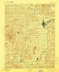
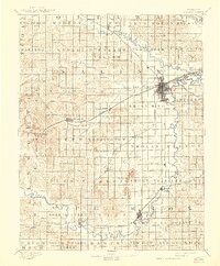
1892 Map of Salina
USGS Topo · Published 1916About this map
Salina serves as the central rail hub of this Central Kansas landscape, where the Union Pacific Railway, Atchison Topeka & Santa Fe Ry., and Missouri Pacific Railway all converge. The topography is dominated by the winding course of the Smoky Hill River and its major tributaries, including Mulberry Creek and Dry Creek. Distinctive landforms such as the Smoky Hills, Soldier Cap Mound, and North Pole Mound rise above the surrounding plains, providing natural landmarks for early settlers.
Find a feature on this map
68 named features on this map. Tap any name to fly to it.
Don’t see what you’re looking for? This feature index may not catch every label — zoom into the map to look around manually.
Map Details
Editions of this 1892 Salina Map
6 editions found
Other maps of this area

1889 · Newton
USGS Topo · 1:125,000

1889 · Abilene
USGS Topo · 1:125,000

1891 · Hutchinson
USGS Topo · 1:125,000

1891 · Clay Center
USGS Topo · 1:125,000

1892 · Salina
USGS Topo · 1:125,000

1892 · Minneapolis
USGS Topo · 1:125,000

1893 · Hutchinson
USGS Topo · 1:125,000

1894 · Ellsworth
USGS Topo · 1:125,000

1894 · Newton
USGS Topo · 1:125,000

1894 · Abilene
USGS Topo · 1:125,000