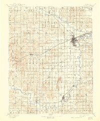
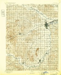
1892 Map of Salina
USGS Topo · Published 1943About this map
Salina serves as the central hub of this 1890s landscape, where the Union Pacific Railway and the Missouri Pacific Railway intersect near the banks of the Smoky Hill River. The map captures a critical period of settlement across Saline and northern McPherson counties, showing the dense network of townships and early prairie towns. To the south, the Swedish heritage of the Smoky Valley is evidenced by the established town of Lindsborg. The terrain is defined by the winding paths of the Saline River and prominent landmarks like Iron Mound and Soldier Cap Mound. Smaller rail stops and settlements such as Terra Cotta, Brookville, and Falun are meticulously plotted along the major rail corridors, illustrating the late 19th-century reliance on steam transport to connect these agricultural communities to the burgeoning city of Salina.
Find a feature on this map
75 named features on this map. Tap any name to fly to it.
Don’t see what you’re looking for? This feature index may not catch every label — zoom into the map to look around manually.
Map Details
Editions of this 1892 Salina Map
6 editions found
Other maps of this area

1889 · Newton
USGS Topo · 1:125,000

1889 · Abilene
USGS Topo · 1:125,000

1891 · Hutchinson
USGS Topo · 1:125,000

1891 · Clay Center
USGS Topo · 1:125,000

1892 · Salina
USGS Topo · 1:125,000

1892 · Minneapolis
USGS Topo · 1:125,000

1893 · Hutchinson
USGS Topo · 1:125,000

1894 · Ellsworth
USGS Topo · 1:125,000

1894 · Newton
USGS Topo · 1:125,000

1894 · Abilene
USGS Topo · 1:125,000