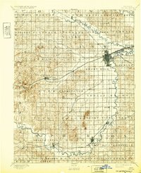
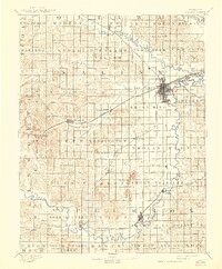
1892 Map of Salina
USGS Topo · Published 1932About this map
The Salina region is captured here in 1890, showing a complex rail and river network during a period of significant expansion in Central Kansas. The junction of the Saline River and Smoky Hill River serves as the geographic anchor for the burgeoning hub of Salina, where multiple rail lines converge, including the Union Pacific Railway and the Missouri Pacific Ry. These iron arteries connect smaller agricultural settlements such as New Cambria, Bavaria, and Brookville.
Find a feature on this map
67 named features on this map. Tap any name to fly to it.
Don’t see what you’re looking for? This feature index may not catch every label — zoom into the map to look around manually.
Map Details
Editions of this 1892 Salina Map
6 editions found
Other maps of this area

1889 · Newton
USGS Topo · 1:125,000

1889 · Abilene
USGS Topo · 1:125,000

1891 · Hutchinson
USGS Topo · 1:125,000

1891 · Clay Center
USGS Topo · 1:125,000

1892 · Salina
USGS Topo · 1:125,000

1892 · Minneapolis
USGS Topo · 1:125,000

1893 · Hutchinson
USGS Topo · 1:125,000

1894 · Ellsworth
USGS Topo · 1:125,000

1894 · Newton
USGS Topo · 1:125,000

1894 · Abilene
USGS Topo · 1:125,000