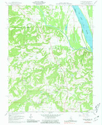
1959 Map of Saline Mines
USGS Topo · Published 1981About this map
The Ohio River flows along the eastern border of this landscape where the Saline River meets the border of Gallatin and Hardin counties. Much of the southern terrain is dominated by the Shawnee National Forest, characterized by numerous named hollows and hills like Tucker Hill. This 1959 survey records an area deeply defined by extraction, specifically within the Mahoning Mines complex and smaller operations such as the Goose Creek Mine, Green Mine, and Victory Mine. These mines are interspersed with local landmarks that suggest a close-knit rural community, including the Shewmaker Sch and various family-named burial grounds like Earnshaw Cem and Dutton Cem. The presence of the Peters Creek Lookout Tower and a Landing Field reflects the mid-century infrastructure managing these wooded and industrial lands.
Find a feature on this map
65 named features on this map. Tap any name to fly to it.
Don’t see what you’re looking for? This feature index may not catch every label — zoom into the map to look around manually.
Map Details
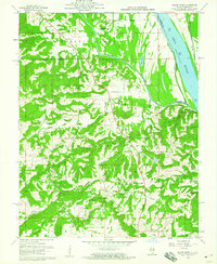
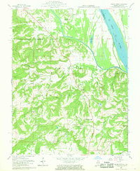
Editions of this 1959 Saline Mines Map
3 editions found
Other maps of this area

1916 · Shawneetown
USGS Topo · 1:62,500

1916 · Fords Ferry
USGS Topo · 1:62,500

1916 · Golconda
USGS Topo · 1:62,500

1916 · Equality
USGS Topo · 1:62,500

1920 · Goloonda
USGS Topo · 1:48,000

1921 · Fords Ferry
USGS Topo · 1:48,000

1921 · Golconda
USGS Topo · 1:62,500

1925 · Cave In Rock
USGS Topo · 1:62,500

1949 · Paducah
USGS Topo · 1:250,000

1950 · Paducah
USGS Topo · 1:250,000