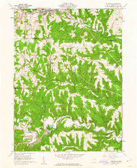
1960 Map of Salineville
USGS Topo · Published 1962About this map
Salineville serves as the industrial and transport hub of this pocket in northeastern Ohio, where the Pennsylvania railroad tracks parallel Yellow Creek. The landscape of the early 1960s is defined by a dense network of coal production, evident in the numerous Strip Mine and Tipple Mine operations scattered throughout Washington and Brush Creek townships. The rugged drainage basins of Salt Run and Roach Run reveal a deeply dissected terrain that influenced settlement patterns, pushing smaller communities like Monroeville and Holt to the higher ridges.
Find a feature on this map
46 named features on this map. Tap any name to fly to it.
Don’t see what you’re looking for? This feature index may not catch every label — zoom into the map to look around manually.
Map Details
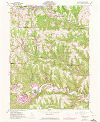
Editions of this 1960 Salineville Map
2 editions found
Other maps of this area

1901 · Cadiz
USGS Topo · 1:62,500

1903 · Cadiz
USGS Topo · 1:62,500

1904 · Wellsville
USGS Topo · 1:62,500

1904 · Steubenville
USGS Topo · 1:62,500

1905 · Salineville
USGS Topo · 1:62,500

1935 · Steubenville
USGS Topo · 1:62,500

1937 · Wellsville
USGS Topo · 1:62,500

1942 · Steubenville
USGS Topo · 1:62,500

1944 · Wellsville
USGS Topo · 1:62,500

1951 · Canton
USGS Topo · 1:250,000