
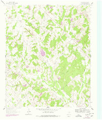
1961 Map of Salona
USGS Topo · Published 1963About this map
The community of Salona sits at a crossroads in southwestern Montague County, serving as a focal point for a landscape defined by rolling hills and petroleum exploration during the early 1960s. This survey reveals a deeply local geography of small settlements and family history, anchored by sites like Denver Sch and the Denver Cem. The terrain is etched by the intricate drainage of Denton Creek and Mallard Creek, which carve through the prominent Dry Valley. Industrial activity is evident in the Mueller Oil Field and Mallard Field, where numerous oil wells dot the countryside alongside a major gas Pipeline. Genealogists will find particular value in the scattered burial grounds, including the Mitchell Cem, Mallard Cem, and Jackson Cem, which mark the generational roots of these rural Texas communities.
Find a feature on this map
27 named features on this map. Tap any name to fly to it.
Don’t see what you’re looking for? This feature index may not catch every label — zoom into the map to look around manually.
Map Details
Editions of this 1961 Salona Map
2 editions found
Other maps of this area

1905 · Montague
USGS Topo · 1:125,000

1954 · Sherman
USGS Topo · 1:250,000

1958 · Sherman
USGS Topo · 1:250,000

1960 · Buzzard Roost Knob
USGS Topo · 1:24,000

1961 · Saint Jo
USGS Topo · 1:24,000

1961 · New Harp
USGS Topo · 1:24,000

1961 · Montague
USGS Topo · 1:24,000

1961 · Sunset
USGS Topo · 1:24,000
1961 · Smyrna
USGS Topo · 1:24,000

1961 · Bowie
USGS Topo · 1:24,000