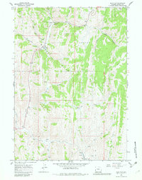
1967 Map of Salt Flat
USGS Topo · Published 1982About this map
The Gannett Hills dominate this portion of the Bridger National Forest, where high-altitude drainages and historical passage routes converge. Along the northern edge of the map, the Emigrant (Lander Cutoff) Trail skirts the terrain, marking a segment of the vital westward migration path used during the mid-19th century. Below the ridge lines, the landscape is defined by the winding course of Salt Creek and Salt Canyon, which provides a natural corridor for movement through the hills.
Find a feature on this map
29 named features on this map. Tap any name to fly to it.
Don’t see what you’re looking for? This feature index may not catch every label — zoom into the map to look around manually.
Map Details
Editions of this 1967 Salt Flat Map
4 editions found
Other maps of this area

1909 · Montpelier
USGS Topo · 1:125,000

1911 · Montpelier
USGS Topo · 1:125,000

1915 · Crow Creek
USGS Topo · 1:62,500

1921 · Afton
USGS Topo · 1:125,000

1936 · Cokeville
USGS Topo · 1:96,000

1942 · Cokeville
USGS Topo · 1:125,000

1955 · Preston
USGS Topo · 1:250,000

1958 · Preston
USGS Topo · 1:250,000

1962 · Preston
USGS Topo · 1:250,000

1967 · Big Park
USGS Topo · 1:24,000