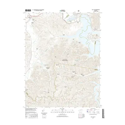
2016 Map of Salt Lick
USGS Topo · Published 2016About this map
Clear Creek Furnace stands as a significant industrial landmark within the Daniel Boone National Forest, signaling the region's historical iron-working legacy. The terrain is defined by a dense network of ridges and hollows, including Wolfpen Hollow and Dark Cave Hollow, which drain toward the expansive Cave Run Lake. Along the northern edge, the settlement of Salt Lick sits near the Licking River, serving as a gateway to the wooded uplands of Bath County. This 2016 survey illustrates a landscape where modern recreation around the reservoir meets deep-seated local history, evidenced by numerous family burial grounds such as Alfrey Cem and Dickerson Cem. Topographic features like Carrington Rock and Tater Knob provide prominent navigational points for those exploring the rugged backcountry of the Cumberland Plateau.
Find a feature on this map
83 named features on this map. Tap any name to fly to it.
Don’t see what you’re looking for? This feature index may not catch every label — zoom into the map to look around manually.
Map Details
Editions of this 2016 Salt Lick Map
This is the sole edition of this map. No revisions or reprints were ever made.
Other maps of this area

1889 · Salyersville
USGS Topo · 1:125,000

1891 · Salyersville
USGS Topo · 1:125,000

1892 · Beattyville
USGS Topo · 1:125,000

1899 · Salyersville
USGS Topo · 1:125,000

1929 · Morehead
USGS Topo · 1:48,000

1929 · Salt Lick
USGS Topo · 1:62,500

1934 · Salt Lick
USGS Topo · 1:62,500

1935 · Morehead
USGS Topo · 1:62,500

1951 · Ezel
USGS Topo · 1:24,000

1952 · Scranton
USGS Topo · 1:24,000