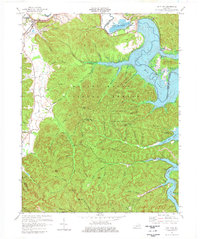
1975 Map of Salt Lick
USGS Topo · Published 1977About this map
The Licking River basin in northeastern Kentucky is the centerpiece of this mid-1970s landscape, dominated by the newly formed Cave Run Lake. This era shows the transition from a traditional river valley to a managed recreational and conservation area within the Daniel Boone National Forest. Evidence of early industry remains at Clear Creek Furnace, while the modern management of the ecosystem is visible through the Clark State Fish Hatchery and the specialized Pioneer Weapons Hunting Area.
Find a feature on this map
75 named features on this map. Tap any name to fly to it.
Don’t see what you’re looking for? This feature index may not catch every label — zoom into the map to look around manually.
Map Details
Editions of this 1975 Salt Lick Map
This is the sole edition of this map. No revisions or reprints were ever made.
Other maps of this area

1889 · Salyersville
USGS Topo · 1:125,000

1891 · Salyersville
USGS Topo · 1:125,000

1892 · Beattyville
USGS Topo · 1:125,000

1899 · Salyersville
USGS Topo · 1:125,000

1929 · Morehead
USGS Topo · 1:48,000

1929 · Salt Lick
USGS Topo · 1:62,500

1934 · Salt Lick
USGS Topo · 1:62,500

1935 · Morehead
USGS Topo · 1:62,500

1951 · Ezel
USGS Topo · 1:24,000

1952 · Scranton
USGS Topo · 1:24,000