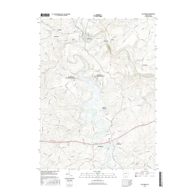
2016 Map of Saltsburg
USGS Topo · Published 2016About this map
The Kiskiminetas River and Conemaugh River converge at Saltsburg, a geographic focal point where the border between Indiana Co and Westmoreland Co is defined by the winding water. This area is characterized by the significant footprint of Loyalhanna Lake and its surrounding protected lands, including Loyalhanna Woodlands Number 1 and Loyalhanna Woodlands Number 2. The landscape is a network of small settlements and rural crossroads, connected by historic routes like the Old William Penn HWY.
Find a feature on this map
115 named features on this map. Tap any name to fly to it.
Don’t see what you’re looking for? This feature index may not catch every label — zoom into the map to look around manually.
Map Details
Editions of this 2016 Saltsburg Map
This is the sole edition of this map. No revisions or reprints were ever made.
Other maps of this area

1900 · Latrobe
USGS Topo · 1:62,500

1902 · Latrobe
USGS Topo · 1:62,500

1902 · Elders Ridge
USGS Topo · 1:62,500

1903 · Latrobe
USGS Topo · 1:62,500

1904 · Elders Ridge
USGS Topo · 1:62,500

1904 · Greensburg
USGS Topo · 1:62,500

1906 · Greensburg
USGS Topo · 1:62,500

1907 · Freeport
USGS Topo · 1:62,500

1909 · Freeport
USGS Topo · 1:62,500

1953 · Pittsburgh
USGS Topo · 1:250,000
Featured Places
- White, Conemaugh Township
- Saltsburg, PA
- New Alexandria, Derry Township
- Salem Township, PA
- Derry Township, PA