
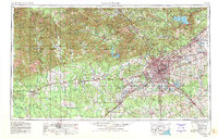
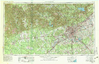
1954 Map of San Antonio
USGS Topo · Published 1964About this map
The Balcones Escarpment serves as a dramatic geological divide on this mid-century survey, separating the high Edwards Plateau from the fertile plains of South Texas. At the center of this landscape, San Antonio appears as a burgeoning hub of military and aviation infrastructure. The city is surrounded by a formidable ring of installations, including Fort Sam Houston (Army), Kelly AFB, Lackland AFB, and Brooks AFB. To the northeast, Randolph AFB and the Camp Bullis Military Reservation further underscore the area's strategic importance during the Cold War era.
Find a feature on this map
152 named features on this map. Tap any name to fly to it.
Don’t see what you’re looking for? This feature index may not catch every label — zoom into the map to look around manually.
Map Details
Editions of this 1954 San Antonio Map
3 editions found
Other maps of this area

1887 · Blanco
USGS Topo · 1:125,000

1893 · Rock Springs
USGS Topo · 1:125,000

1893 · Nueces
USGS Topo · 1:125,000

1894 · Fredericksburg
USGS Topo · 1:125,000

1894 · Kerrville
USGS Topo · 1:125,000

1894 · Blanco
USGS Topo · 1:125,000

1896 · Nueces
USGS Topo · 1:125,000

1896 · Brackett
USGS Topo · 1:125,000

1896 · Austin
USGS Topo · 1:125,000

1897 · Brackett
USGS Topo · 1:125,000