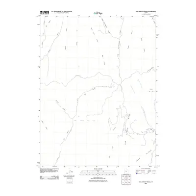
2011 Map of San Arroyo Ridge
USGS Topo · Published 2011About this map
San Arroyo Ridge and the towering Book Cliffs define this high-desert landscape in Uintah County, where the terrain is carved by a complex network of drainages. The area is dominated by energy extraction and remote navigation, centered around the East Canyon Gas Field and Overlook Gas Field. These industrial footprints are connected by a sparse network of mountain routes, including East Canyon Rd and McCook Ridge Rd, which trace the natural contours of the ridges and canyons.
Find a feature on this map
29 named features on this map. Tap any name to fly to it.
Don’t see what you’re looking for? This feature index may not catch every label — zoom into the map to look around manually.
Map Details
Editions of this 2011 San Arroyo Ridge Map
This is the sole edition of this map. No revisions or reprints were ever made.
Other maps of this area

1885 · East Tavaputs
USGS Topo · 1:250,000

1956 · Grand Junction
USGS Topo · 1:250,000

1959 · Grand Junction
USGS Topo · 1:250,000

1960 · Grand Junction
USGS Topo · 1:250,000

1962 · Grand Junction
USGS Topo · 1:250,000

1964 · Grand Junction
USGS Topo · 1:250,000

1965 · Grand Junction
USGS Topo · 1:250,000

1966 · Seep Canyon
USGS Topo · 1:24,000

1966 · Tom Patterson Canyon
USGS Topo · 1:24,000
1966 · Rat Hole Ridge
USGS Topo · 1:24,000