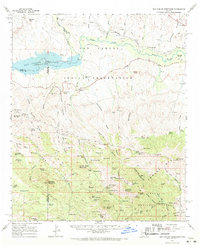
1962 Map of San Carlos Reservoir
USGS Topo · Published 1971About this map
The San Carlos Reservoir serves as the focal point of this 1962 field-checked survey, where the Gila River and San Carlos River converge within the San Carlos Indian Reservation. The landscape is a complex network of arid washes and draws, including Apache Wash and Chittakow Draw, leading into the high elevations of the Santa Teresa Mountains. Historical human activity is visible through an Indian Cemetery near the reservoir and several mining operations tucked into the canyons, such as the Starlight Mine and Copper Reef Mine.
Find a feature on this map
91 named features on this map. Tap any name to fly to it.
Don’t see what you’re looking for? This feature index may not catch every label — zoom into the map to look around manually.
Map Details
Editions of this 1962 San Carlos Reservoir Map
3 editions found

Other maps of this area

1911 · Winkelman
USGS Topo · 1:125,000

1913 · Winkelman
USGS Topo · 1:125,000

1915 · Christmas
USGS Topo · 1:62,500

1917 · Christmas
USGS Topo · 1:62,500

1938 · Klondyke
USGS Topo · 1:48,000

1943 · Klondyke
USGS Topo · 1:62,500

1944 · Jackson Mtn.
USGS Topo · 1:62,500

1946 · Jackson Mtn.
USGS Topo · 1:62,500

1949 · Holy Joe Peak
USGS Topo · 1:62,500

1949 · Brandenburg Mtn
USGS Topo · 1:24,000