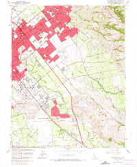
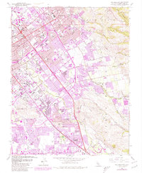
1961 Map of San Jose East
USGS Topo · Published 1967About this map
San Jose spreads toward the eastern foothills in this early 1960s snapshot, showing a landscape in rapid transition from agricultural tracts to suburban neighborhoods. The city's eastern reaches are anchored by the Alum Rock district and the vast Pueblo Lands of San Jose, where the grid of new streets meets the winding courses of Coyote Creek and Silver Creek. Regional recreation and industry define the area, from the County Fairgrounds and San Jose Speedway to the extractive history visible at the Hillsdale Mine and the New North Almaden Mine in the southern hills.
Find a feature on this map
52 named features on this map. Tap any name to fly to it.
Don’t see what you’re looking for? This feature index may not catch every label — zoom into the map to look around manually.
Map Details
Editions of this 1961 San Jose East Map
5 editions found
Other maps of this area

1889 · San Jose
USGS Topo · 1:62,500

1897 · San Jose
USGS Topo · 1:62,500

1897 · Mt. Hamilton
USGS Topo · 1:62,500

1899 · San Jose
USGS Topo · 1:62,500

1916 · New Almaden
USGS Topo · 1:48,000

1917 · Morgan Hill
USGS Topo · 1:62,500

1919 · New Almaden
USGS Topo · 1:62,500

1939 · Morgan Hill
USGS Topo · 1:62,500

1940 · Los Gatos
USGS Topo · 1:62,500

1941 · Morgan Hill
USGS Topo · 1:62,500