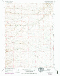
1968 Map of Sand Butte Rim SE
USGS Topo · Published 1978About this map
Eversole Ranch stands as a primary point of human habitation in this arid expanse of Sweetwater County, where the landscape is defined by a complex network of intermittent drainages. Water management is central to the area's utility, evidenced by features like the Bull Pasture Well, Rife Flowing Well, and a Dry Reservoir. These labels suggest a reliance on subterranean sources and seasonal runoff to support ranching operations in a high-desert environment.
Find a feature on this map
13 named features on this map. Tap any name to fly to it.
Don’t see what you’re looking for? This feature index may not catch every label — zoom into the map to look around manually.
Map Details
Editions of this 1968 Sand Butte Rim SE Map
2 editions found
Other maps of this area

1954 · Rock Springs
USGS Topo · 1:250,000

1958 · Rock Springs
USGS Topo · 1:250,000

1962 · Rock Springs
USGS Topo · 1:250,000

1968 · Chicken Creek East
USGS Topo · 1:24,000

1968 · Sand Butte Rim NW
USGS Topo · 1:24,000

1968 · Pine Butte
USGS Topo · 1:24,000

1968 · Sand Butte Rim SE
USGS Topo · 1:24,000
1968 · Antelope Flats
USGS Topo · 1:24,000
1968 · Chicken Creek West
USGS Topo · 1:24,000

1970 · Cow Creek Reservoir
USGS Topo · 1:24,000