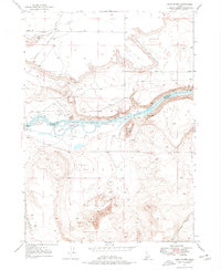
1947 Map of Sand Dunes
USGS Topo · Published 1977About this map
The Snake River carves through this Owyhee County landscape, serving as the border between Elmore and Owyhee counties. The map documents a critical corridor of western transit, showing the Old Mountain City Freight Trail and the Emigrant Trail navigating the difficult terrain near the riverbanks. Riverside features like Wilkins Island and Blacks I sit within the channel, while the Loveridge Bridge provides one of the few crossings in the area.
Find a feature on this map
17 named features on this map. Tap any name to fly to it.
Don’t see what you’re looking for? This feature index may not catch every label — zoom into the map to look around manually.
Map Details
Editions of this 1947 Sand Dunes Map
4 editions found
Other maps of this area

1892 · Mountain Home
USGS Topo · 1:125,000

1893 · Mountain Home
USGS Topo · 1:125,000

1947 · Bruneau
USGS Topo · 1:62,500

1947 · Indian Cove
USGS Topo · 1:24,000

1947 · Sand Dunes
USGS Topo · 1:24,000

1947 · Bruneau
USGS Topo · 1:24,000

1947 · Sugar Valley
USGS Topo · 1:24,000

1947 · Hot Spring
USGS Topo · 1:24,000

1948 · Sand Dunes
USGS Topo · 1:24,000

1948 · Indian Cove
USGS Topo · 1:24,000