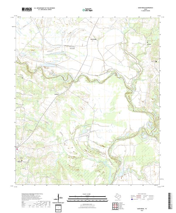
2022 Map of Sand Ridge
USGS Topo · Published 2022About this map
The Trinity River defines the winding boundary between Madison and Houston counties, carving through a landscape characterized by riparian lowlands and sandy ridges. The community of Sand Ridge sits at a highway junction in the north, while smaller settlements like Antioch and Vistula are distributed along the rural road network. Local genealogy is anchored by several historic burial grounds, including Bozeman Cem and the Midway Southside Cem near the southern settlement of Midway.
Find a feature on this map
60 named features on this map. Tap any name to fly to it.
Don’t see what you’re looking for? This feature index may not catch every label — zoom into the map to look around manually.
Map Details
Editions of this 2022 Sand Ridge Map
This is the sole edition of this map. No revisions or reprints were ever made.
Other maps of this area

1953 · Palestine
USGS Topo · 1:250,000

1954 · Beaumont
USGS Topo · 1:250,000

1957 · Beaumont
USGS Topo · 1:250,000

1957 · Palestine
USGS Topo · 1:250,000

1962 · Connor
USGS Topo · 1:24,000

1962 · Wyser Bottom
USGS Topo · 1:24,000

1962 · Baker Lake
USGS Topo · 1:24,000

1964 · Sand Ridge
USGS Topo · 1:24,000

1964 · Austonio
USGS Topo · 1:24,000

1964 · Pearsons Chapel
USGS Topo · 1:24,000