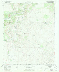
1968 Map of Sanders Hollow
USGS Topo · Published 1981About this map
Tongue South Pease River and the North Wichita River headwaters dominate this West Texas landscape along the border of Motley and Dickens Counties. In the late 1960s, this area was characterized by a sparsely settled ranching economy, with life revolving around widely spaced water sources and family-named windmills. The ranching infrastructure is anchored by Red Lake Ranch, which maintained its own Red Lake Ranch Airfield and several outlying structures.
Find a feature on this map
27 named features on this map. Tap any name to fly to it.
Don’t see what you’re looking for? This feature index may not catch every label — zoom into the map to look around manually.
Map Details
Editions of this 1968 Sanders Hollow Map
2 editions found
Other maps of this area

1954 · Lubbock
USGS Topo · 1:250,000

1967 · Dickens North
USGS Topo · 1:24,000

1968 · East Afton
USGS Topo · 1:24,000

1968 · Roaring Springs
USGS Topo · 1:24,000

1968 · Russellville
USGS Topo · 1:24,000

1968 · Dumont
USGS Topo · 1:24,000

1968 · China Canyon
USGS Topo · 1:24,000

1968 · East Afton NE
USGS Topo · 1:24,000

1968 · Sanders Hollow
USGS Topo · 1:24,000

1968 · Afton
USGS Topo · 1:24,000