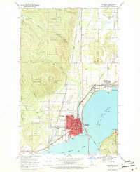
1968 Map of Sandpoint
USGS Topo · Published 1971About this map
Sandpoint serves as the hub of this Idaho landscape, situated where the Pend Oreille River meets the expansive Lake Pend Oreille. The town’s urban grid is dense with civic landmarks, including the Courthouse, City Hall, and several educational institutions like Lincoln Sch and Washington Sch. A sophisticated rail network defines the era's transport economy, with tracks of the Great Northern, Spokane International, and Spokane Pacific converging near the shoreline.
Find a feature on this map
48 named features on this map. Tap any name to fly to it.
Don’t see what you’re looking for? This feature index may not catch every label — zoom into the map to look around manually.
Map Details
Editions of this 1968 Sandpoint Map
2 editions found
Other maps of this area

1901 · Sandpoint
USGS Topo · 1:125,000

1911 · Priest Lake
USGS Topo · 1:250,000

1911 · Sandpoint
USGS Topo · 1:125,000

1913 · Priest Lake
USGS Topo · 1:250,000

1949 · Packsaddle Mtn
USGS Topo · 1:62,500

1951 · Packsaddle Mtn
USGS Topo · 1:62,500

1951 · Elmira
USGS Topo · 1:62,500

1958 · Sandpoint
USGS Topo · 1:250,000

1963 · Sandpoint
USGS Topo · 1:250,000
1968 · Happy Fork Gap
USGS Topo · 1:24,000