
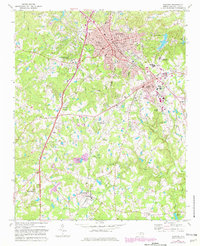
1974 Map of Sanford
USGS Topo · Published 1977About this map
Sanford serves as a major hub of industry and transport in the mid-1970s, defined by a dense intersection of the Southern, Seaboard Coast Line Railroad, and Atlantic and Western lines. The urban core extends southeast toward Jonesboro Heights, while the surrounding landscape transitions into rural communities like Lemon Springs and Tramway. The map captures an era of infrastructure development, featuring the Sanford Municipal Airport and active Claypits near the northern boundary, reflecting the area's geological and economic character. Local life is centered around numerous country congregations and small schools, such as Shallow Well Ch and the McIver Sch. Natural drainage patterns are dictated by Buffalo Creek and Upper Little River, which meander through a terrain punctuated by family-named landmarks like Mc Queen Cem.
Find a feature on this map
51 named features on this map. Tap any name to fly to it.
Don’t see what you’re looking for? This feature index may not catch every label — zoom into the map to look around manually.
Map Details
Editions of this 1974 Sanford Map
2 editions found
Other maps of this area

1953 · Raleigh
USGS Topo · 1:250,000

1954 · Raleigh
USGS Topo · 1:250,000

1957 · Murchisontown
USGS Topo · 1:24,000
1957 · Olivia
USGS Topo · 1:24,000

1970 · Goldston
USGS Topo · 1:24,000

1970 · Colon
USGS Topo · 1:24,000

1970 · Moncure
USGS Topo · 1:24,000

1974 · White Hill
USGS Topo · 1:24,000
1974 · Vass
USGS Topo · 1:24,000
1977 · Broadway
USGS Topo · 1:24,000