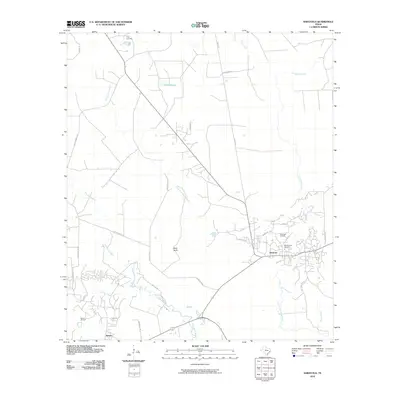
2010 Map of Saratoga
USGS Topo · Published 2010About this map
Saratoga Oil Field and Batson Oil Field anchor this region of the Texas Big Thicket, reflecting a landscape long defined by petroleum extraction and timber. The industrial character of the area is underscored by historical transportation routes like the Durden Tram and E Batson Mainline, which cut through the dense network of bayous and sloughs. Settlement is concentrated around the towns of Saratoga and Batson, where local history is preserved at the Middle Town Cemetery.
Find a feature on this map
35 named features on this map. Tap any name to fly to it.
Don’t see what you’re looking for? This feature index may not catch every label — zoom into the map to look around manually.
Map Details
Editions of this 2010 Saratoga Map
This is the sole edition of this map. No revisions or reprints were ever made.
Other maps of this area

1943 · Liberty
USGS Topo · 1:125,000

1954 · Beaumont
USGS Topo · 1:250,000

1955 · Daisetta
USGS Topo · 1:62,500

1955 · Saratoga
USGS Topo · 1:62,500

1955 · Kountze
USGS Topo · 1:62,500

1955 · Sour Lake
USGS Topo · 1:62,500

1957 · Beaumont
USGS Topo · 1:250,000

1984 · Beaumont
USGS Topo · 1:250,000

1984 · Sour Lake
USGS Topo · 1:24,000
1984 · Saratoga
USGS Topo · 1:24,000