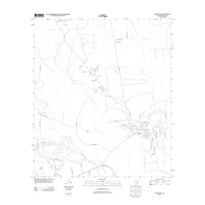
2013 Map of Saratoga
USGS Topo · Published 2013About this map
Saratoga remains the primary hub of this Hardin County landscape, situated amidst the complex network of wetlands that define the East Texas piney woods. The regional economy is anchored by the Saratoga Oil Field and Batson Oil Field, which illustrate the industrial legacy of the Beaumont area. These petroleum interests are balanced by the presence of the Big Thicket National Preserve, which protects the unique biodiversity of the local river systems. Drainage patterns are dominated by Pine Island Bayou and its numerous tributaries, including Little Pine Island Bayou and Steepbank Cr. Historically significant sites like Mid Town Cem and Felps Cem offer valuable points of reference for genealogists, while land features such as Shinglemill Slough and Wolf Gully highlight the intricate, water-logged nature of the terrain.
Find a feature on this map
72 named features on this map. Tap any name to fly to it.
Don’t see what you’re looking for? This feature index may not catch every label — zoom into the map to look around manually.
Map Details
Editions of this 2013 Saratoga Map
This is the sole edition of this map. No revisions or reprints were ever made.
Other maps of this area

1943 · Liberty
USGS Topo · 1:125,000

1954 · Beaumont
USGS Topo · 1:250,000

1955 · Daisetta
USGS Topo · 1:62,500

1955 · Saratoga
USGS Topo · 1:62,500

1955 · Kountze
USGS Topo · 1:62,500

1955 · Sour Lake
USGS Topo · 1:62,500

1957 · Beaumont
USGS Topo · 1:250,000

1984 · Beaumont
USGS Topo · 1:250,000

1984 · Sour Lake
USGS Topo · 1:24,000
1984 · Saratoga
USGS Topo · 1:24,000