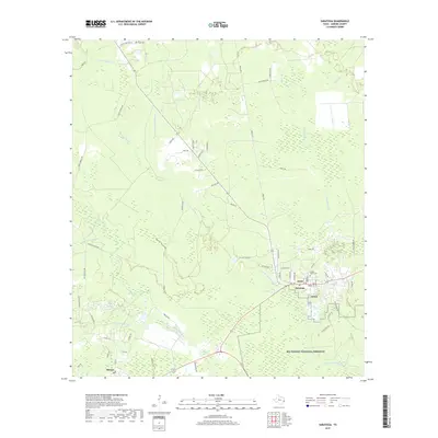
2019 Map of Saratoga
USGS Topo · Published 2019About this map
Saratoga and Batson anchor this portion of Hardin County, appearing as small settlements amidst the dense hydrological network of the Big Thicket National Preserve. The landscape is defined by the winding course of Pine Island Bayou and its numerous tributaries, including Little Pine Island Bayou and Shinglemill Slough. These waterways create a complex environment of sloughs and gullies, such as Mayhaw Slough and Wolf Gully, which have historically shaped the local timber and oil industries.
Find a feature on this map
64 named features on this map. Tap any name to fly to it.
Don’t see what you’re looking for? This feature index may not catch every label — zoom into the map to look around manually.
Map Details
Editions of this 2019 Saratoga Map
This is the sole edition of this map. No revisions or reprints were ever made.
Other maps of this area

1943 · Liberty
USGS Topo · 1:125,000

1954 · Beaumont
USGS Topo · 1:250,000

1955 · Daisetta
USGS Topo · 1:62,500

1955 · Saratoga
USGS Topo · 1:62,500

1955 · Kountze
USGS Topo · 1:62,500

1955 · Sour Lake
USGS Topo · 1:62,500

1957 · Beaumont
USGS Topo · 1:250,000

1984 · Beaumont
USGS Topo · 1:250,000

1984 · Sour Lake
USGS Topo · 1:24,000
1984 · Saratoga
USGS Topo · 1:24,000