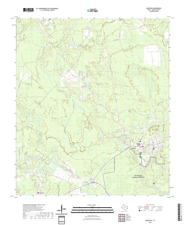
2022 Map of Saratoga
USGS Topo · Published 2022About this map
The Big Thicket National Preserve dominates this portion of Hardin County, protecting a complex landscape of wetlands and watercourses. Within this dense environmental mosaic, the community of Saratoga sits at a junction of regional roads like FM 787, surrounded by names that hint at the area's industrial past. The presence of Oiltown Cem and Midtown Cem near the town center reflects the settlement patterns of the Texas oil boom era. To the southwest, Batson anchors another pocket of development amidst the bottomlands.
Find a feature on this map
69 named features on this map. Tap any name to fly to it.
Don’t see what you’re looking for? This feature index may not catch every label — zoom into the map to look around manually.
Map Details
Editions of this 2022 Saratoga Map
This is the sole edition of this map. No revisions or reprints were ever made.
Other maps of this area

1943 · Liberty
USGS Topo · 1:125,000

1954 · Beaumont
USGS Topo · 1:250,000

1955 · Daisetta
USGS Topo · 1:62,500

1955 · Saratoga
USGS Topo · 1:62,500

1955 · Kountze
USGS Topo · 1:62,500

1955 · Sour Lake
USGS Topo · 1:62,500

1957 · Beaumont
USGS Topo · 1:250,000

1984 · Beaumont
USGS Topo · 1:250,000

1984 · Sour Lake
USGS Topo · 1:24,000
1984 · Saratoga
USGS Topo · 1:24,000