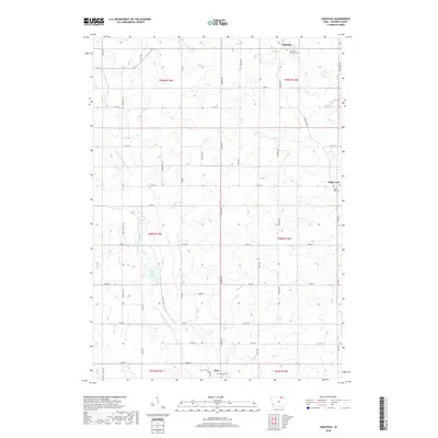
2018 Map of Saratoga
USGS Topo · Published 2018About this map
The Little Wapsipinicon River meanders across this rural Howard County landscape, carving through a region defined by agricultural grids and small crossroad communities. In the northern reaches, the settlement of Saratoga stands near the Saratoga Township Cem, while the eastern border features the quiet hamlet of Maple Leaf and its namesake Maple Leaf Cem. This area is part of the low-relief drift plain of northeast Iowa, where drainage is managed through a network of small tributaries like Mead Cr and Elk Cr.
Find a feature on this map
43 named features on this map. Tap any name to fly to it.
Don’t see what you’re looking for? This feature index may not catch every label — zoom into the map to look around manually.
Map Details
Editions of this 2018 Saratoga Map
This is the sole edition of this map. No revisions or reprints were ever made.
Other maps of this area

1954 · Mason City
USGS Topo · 1:250,000

1957 · Mason City
USGS Topo · 1:250,000

1958 · Mason City
USGS Topo · 1:250,000

1971 · Colwell
USGS Topo · 1:24,000

1972 · Mc Intire
USGS Topo · 1:24,000

1972 · Riceville
USGS Topo · 1:24,000

1972 · Elma
USGS Topo · 1:24,000

1972 · Jerico
USGS Topo · 1:24,000

1981 · Lourdes
USGS Topo · 1:24,000

1981 · Lime Springs
USGS Topo · 1:24,000