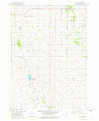
1981 Map of Saratoga
USGS Topo · Published 1982About this map
The Little Wapsipinicon River meanders through the western half of this Howard County landscape, defining the rural character of the Jamestown and Saratoga townships. By the early 1980s, the area remained a network of family farms connected by a grid of section roads, with the community of Saratoga serving as a local hub near Lubbert Park. To the southeast, the small settlement of Maple Leaf sits near Roman Park, while the southern edge of the sheet captures the outskirts of Elma.
Find a feature on this map
19 named features on this map. Tap any name to fly to it.
Don’t see what you’re looking for? This feature index may not catch every label — zoom into the map to look around manually.
Map Details
Editions of this 1981 Saratoga Map
This is the sole edition of this map. No revisions or reprints were ever made.
Other maps of this area

1954 · Mason City
USGS Topo · 1:250,000

1957 · Mason City
USGS Topo · 1:250,000

1958 · Mason City
USGS Topo · 1:250,000

1971 · Colwell
USGS Topo · 1:24,000

1972 · Mc Intire
USGS Topo · 1:24,000

1972 · Riceville
USGS Topo · 1:24,000

1972 · Elma
USGS Topo · 1:24,000

1972 · Jerico
USGS Topo · 1:24,000

1981 · Lourdes
USGS Topo · 1:24,000

1981 · Lime Springs
USGS Topo · 1:24,000