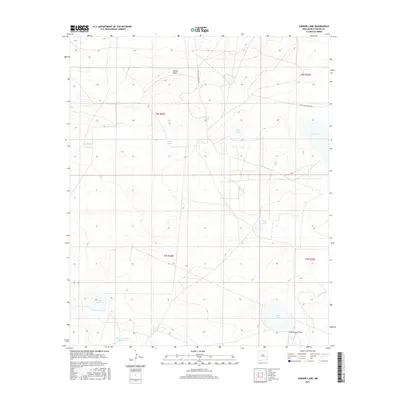
2017 Map of Sardine Lake
USGS Topo · Published 2017About this map
Palma Mesa rises above a high-desert landscape defined by vital water resources in rural Chaves County. This terrain is characterized by a network of catchments and natural depressions essential for ranching and wildlife in the American Southwest. Distinctive water features like Sardine Lake, Adobe Lake, and Deep Lake punctuate the arid surroundings, while man-made improvements such as House Tank, Moon Tank, and the humorously named Madison Square Garden Tank show the extensive infrastructure required to support livestock. Navigational access is provided primarily by White Lake Ranch Rd, which cuts across the northern townships. The drainage patterns of the region are clearly visible through Long Arroyo Draw and Long Arroyo, tracing the natural movement of seasonal water across the basin near Twin Lakes and Red Lake.
Find a feature on this map
20 named features on this map. Tap any name to fly to it.
Don’t see what you’re looking for? This feature index may not catch every label — zoom into the map to look around manually.
Map Details
Editions of this 2017 Sardine Lake Map
This is the sole edition of this map. No revisions or reprints were ever made.
Other maps of this area

1949 · Sardine Mountain
USGS Topo · 1:24,000

1949 · L-E Ranch
USGS Topo · 1:24,000

1954 · Brownfield
USGS Topo · 1:250,000

1955 · Roswell
USGS Topo · 1:250,000

1958 · Brownfield
USGS Topo · 1:250,000

1958 · Roswell
USGS Topo · 1:250,000

1962 · Roswell
USGS Topo · 1:250,000

1962 · Brownfield
USGS Topo · 1:250,000
1967 · Campbell
USGS Topo · 1:24,000

1967 · Haystack Mountain
USGS Topo · 1:24,000