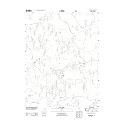
2012 Map of Sardine Peak
USGS Topo · Published 2012About this map
Sardine Peak and the high country of the Sierra Nevada are defined by a network of seasonal watercourses and remote camps in this 2012 survey. The landscape is oriented around Bear Valley, where Bear Valley Campground sits near the headwaters of Bear Valley Cr. This area maintains a strong connection to its pastoral and transmountain history, evidenced by Wheelers Sheep Camp and Kyburz Flat in the southern reaches of the quadrangle.
Find a feature on this map
26 named features on this map. Tap any name to fly to it.
Don’t see what you’re looking for? This feature index may not catch every label — zoom into the map to look around manually.
Map Details
Editions of this 2012 Sardine Peak Map
This is the sole edition of this map. No revisions or reprints were ever made.
Other maps of this area

1890 · Sierraville
USGS Topo · 1:125,000

1891 · Truckee
USGS Topo · 1:125,000

1892 · Sierraville
USGS Topo · 1:125,000

1893 · Truckee
USGS Topo · 1:125,000

1894 · Sierraville
USGS Topo · 1:125,000

1895 · Truckee
USGS Topo · 1:125,000

1932 · Truckee
USGS Topo · 1:96,000

1940 · Truckee
USGS Topo · 1:125,000

1955 · Loyalton
USGS Topo · 1:62,500
1955 · Donner Pass
USGS Topo · 1:62,500