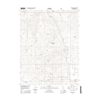
2015 Map of Sardine Peak
USGS Topo · Published 2015About this map
Kyburz Flat and Bear Valley define this portion of the Tahoe National Forest, where high-elevation basins meet the rugged Sierra Nevada terrain. The landscape is oriented around a series of prominent peaks and ridgelines, most notably Sardine Peak and Land Peak, which divide drainage systems like Bear Valley Cr and Smithneck Cr. Historically significant routes, including Henness Pass Rd, cut through the southern portion of the quadrangle near Groundhog Rock, following the natural contours of the mountain passes. The presence of the Stampede Reservoir and its adjacent Stampede Valley in the southeast corner marks a significant point of water management and recreation within the forest. Local landmarks such as Pats Meadow, Sardine Spring, and Sardine Point provide specific geographic anchors for those navigating the canyons and timbered slopes of this region.
Find a feature on this map
36 named features on this map. Tap any name to fly to it.
Don’t see what you’re looking for? This feature index may not catch every label — zoom into the map to look around manually.
Map Details
Editions of this 2015 Sardine Peak Map
This is the sole edition of this map. No revisions or reprints were ever made.
Other maps of this area

1890 · Sierraville
USGS Topo · 1:125,000

1891 · Truckee
USGS Topo · 1:125,000

1892 · Sierraville
USGS Topo · 1:125,000

1893 · Truckee
USGS Topo · 1:125,000

1894 · Sierraville
USGS Topo · 1:125,000

1895 · Truckee
USGS Topo · 1:125,000

1932 · Truckee
USGS Topo · 1:96,000

1940 · Truckee
USGS Topo · 1:125,000

1955 · Loyalton
USGS Topo · 1:62,500
1955 · Donner Pass
USGS Topo · 1:62,500