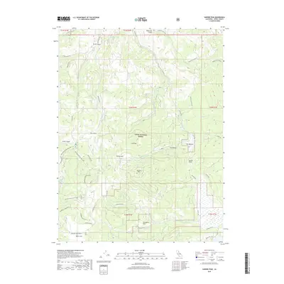
2018 Map of Sardine Peak
USGS Topo · Published 2018About this map
Tahoe National Forest encompasses this high Sierra landscape, dominated by the prominent elevation of Sardine Peak and the surrounding drainages of Smithneck Cr and Davies Cr. The map details a specialized network of seasonal and recreational access, featuring the Main Bear Valley OHV Loop and dedicated winter routes like Wheeler Loop (Snow) and Kyburz (Snow). These paths reflect the modern shift from historical passage to managed recreation within the forest boundaries.
Find a feature on this map
40 named features on this map. Tap any name to fly to it.
Don’t see what you’re looking for? This feature index may not catch every label — zoom into the map to look around manually.
Map Details
Editions of this 2018 Sardine Peak Map
This is the sole edition of this map. No revisions or reprints were ever made.
Other maps of this area

1890 · Sierraville
USGS Topo · 1:125,000

1891 · Truckee
USGS Topo · 1:125,000

1892 · Sierraville
USGS Topo · 1:125,000

1893 · Truckee
USGS Topo · 1:125,000

1894 · Sierraville
USGS Topo · 1:125,000

1895 · Truckee
USGS Topo · 1:125,000

1932 · Truckee
USGS Topo · 1:96,000

1940 · Truckee
USGS Topo · 1:125,000

1955 · Loyalton
USGS Topo · 1:62,500
1955 · Donner Pass
USGS Topo · 1:62,500