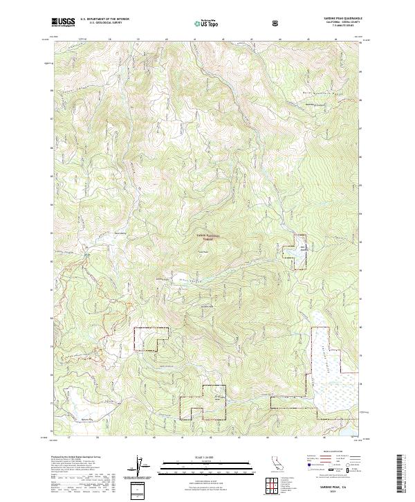
2021 Map of Sardine Peak
USGS Topo · Published 2021About this map
Sardine Peak and its surrounding high-country terrain define this section of the Tahoe National Forest in Sierra County. The landscape is marked by a complex system of drainage and relief, including the deep cuts of Badenaugh Canyon and Turner Canyon. Waterways such as Smithneck Cr and Bear Valley Cr thread through the meadows and valleys, most notably at Pats Meadow and the broad expanse of Kyburz Flat to the south. Historically significant routes cross this area, including the Henness Pass Rd, a vital trans-Sierra passage used by emigrants and freight wagons. The map also detail modern recreational and access routes like the Boca-Loyalton Trl and the Main Bear Valley Ohv Loop Trl, illustrating the evolution from pioneer thoroughfares to contemporary forest management and recreation.
Find a feature on this map
42 named features on this map. Tap any name to fly to it.
Don’t see what you’re looking for? This feature index may not catch every label — zoom into the map to look around manually.
Map Details
Editions of this 2021 Sardine Peak Map
This is the sole edition of this map. No revisions or reprints were ever made.
Other maps of this area

1890 · Sierraville
USGS Topo · 1:125,000

1891 · Truckee
USGS Topo · 1:125,000

1892 · Sierraville
USGS Topo · 1:125,000

1893 · Truckee
USGS Topo · 1:125,000

1894 · Sierraville
USGS Topo · 1:125,000

1895 · Truckee
USGS Topo · 1:125,000

1932 · Truckee
USGS Topo · 1:96,000

1940 · Truckee
USGS Topo · 1:125,000

1955 · Loyalton
USGS Topo · 1:62,500
1955 · Donner Pass
USGS Topo · 1:62,500