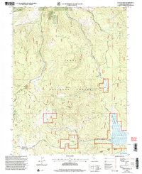
2000 Map of Sardine Peak
USGS Topo · Published 2003About this map
Tahoe National Forest dominates this mountain landscape at the turn of the millennium, revealing a network of forestry roads and historic stations within Sierra County. The presence of Lewis Mill Station and Wheelers Sheep Camp points to the area's history of high-country grazing and timber activity, while the Moore's Station Interpretive Trail at Kyburz Flat suggests a modern shift toward recreation and public land education. A complex hydrographic system is mapped in detail, where Smithneck Creek and Bear Valley Creek drain the rugged ridges of the Bald Mountain Range. In the southern portion of the sheet, the map captures the northern edge of the Stampede Reservoir spillway and the broad expanse of the Sardine Valley. Prominent peaks like Sardine Peak and Land Peak stand as sentinels over the transit corridors of Henness Pass Road and Smithneck Road.
Find a feature on this map
49 named features on this map. Tap any name to fly to it.
Don’t see what you’re looking for? This feature index may not catch every label — zoom into the map to look around manually.
Map Details
Editions of this 2000 Sardine Peak Map
This is the sole edition of this map. No revisions or reprints were ever made.
Other maps of this area

1890 · Sierraville
USGS Topo · 1:125,000

1891 · Truckee
USGS Topo · 1:125,000

1892 · Sierraville
USGS Topo · 1:125,000

1893 · Truckee
USGS Topo · 1:125,000

1894 · Sierraville
USGS Topo · 1:125,000

1895 · Truckee
USGS Topo · 1:125,000

1932 · Truckee
USGS Topo · 1:96,000

1940 · Truckee
USGS Topo · 1:125,000

1955 · Loyalton
USGS Topo · 1:62,500
1955 · Donner Pass
USGS Topo · 1:62,500