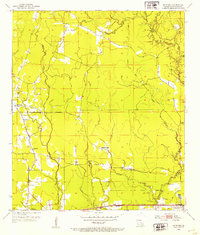
1953 Map of Satsuma
USGS Topo · Published 1954About this map
The Illinois Central railroad corridor serves as the primary East-West artery through this portion of Livingston Parish in the early 1950s, connecting the settlements of Walker and Satsuma. The landscape is defined by the winding paths of Middle Colyell Creek and Hornsby Creek, which drain a countryside transitioning from traditional rail-side commerce to modern road networks. Evidence of the area's timber history is visible in the Old Railroad Grade and the Lookout Tower positioned for fire watch.
Find a feature on this map
23 named features on this map. Tap any name to fly to it.
Don’t see what you’re looking for? This feature index may not catch every label — zoom into the map to look around manually.
Map Details
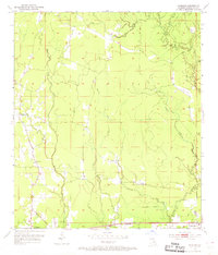
Editions of this 1953 Satsuma Map
2 editions found
Other maps of this area

1934 · Denham Springs
USGS Topo · 1:62,500

1934 · Springfield
USGS Topo · 1:62,500

1939 · Springfield
USGS Topo · 1:62,500

1939 · Denham Springs
USGS Topo · 1:62,500

1942 · Montpelier
USGS Topo · 1:31,680

1942 · Pine Grove
USGS Topo · 1:31,680

1942 · Pride
USGS Topo · 1:31,680

1942 · Watson
USGS Topo · 1:31,680

1942 · Satsuma
USGS Topo · 1:31,680

1950 · Doyle
USGS Topo · 1:31,680