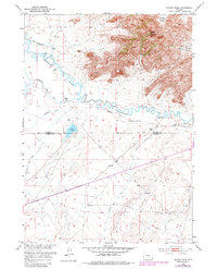
1951 Map of Savage Peak
USGS Topo · Published 1982About this map
The Oregon Trail cuts through this high-desert landscape in the mid-20th century, following the southern banks of the meandering Sweetwater River. This map captures a crucial segment of the emigrant route near the border of Natrona and Carbon Counties, where a solitary Historical Marker stands as a monument to the overland journey. The terrain is defined by dramatic elevation changes, rising from the river valley toward the prominent Savage Peak and its surrounding topographical features like Savage Pocket and Ordway Pocket. Natural drainage patterns are well-documented, with named waterways such as Whiskey Creek, Muddy Creek, and Cherry Creek feeding into the Sweetwater. South of the river, Jackson Lake provides a notable landmark amidst the high-plains topography, while a modern Pipeline suggests the shifting industrial use of this historically significant corridor.
Find a feature on this map
13 named features on this map. Tap any name to fly to it.
Don’t see what you’re looking for? This feature index may not catch every label — zoom into the map to look around manually.
Map Details
Editions of this 1951 Savage Peak Map
3 editions found
Other maps of this area

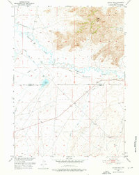
1951 · Savage Peak
USGS Topo · 1:24,000

1951 · Bucklin Reservoirs
USGS Topo · 1:24,000

1951 · Independence Rock
USGS Topo · 1:24,000

1951 · Lone Mountain
USGS Topo · 1:24,000

1953 · Spanish Mine
USGS Topo · 1:24,000

1955 · Casper
USGS Topo · 1:250,000

1958 · Casper
USGS Topo · 1:250,000

1959 · Miller Spring
USGS Topo · 1:24,000
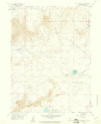
1959 · Beulah Belle Lake
USGS Topo · 1:24,000

1962 · Casper
USGS Topo · 1:250,000