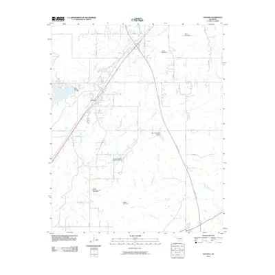
2010 Map of Savanna
USGS Topo · Published 2010About this map
The town of Savanna serves as the central hub of this Pittsburg County landscape, situated at the intersection of a developed road grid and the diagonal corridor of Old Hwy 69. The surrounding terrain is defined by a series of prominent elevations, including Shoat Mountain, Piney Mountain, and Wade Mountain, which steer the drainage of numerous local waterways. The mapping reveals a concerted effort in water management along Peaceable Creek, evidenced by multiple structures such as Brushy Peaceable Creek Site 31 Dam and its counterparts, sites 32 and 33.
Find a feature on this map
36 named features on this map. Tap any name to fly to it.
Don’t see what you’re looking for? This feature index may not catch every label — zoom into the map to look around manually.
Map Details
Editions of this 2010 Savanna Map
This is the sole edition of this map. No revisions or reprints were ever made.
Other maps of this area

1898 · McAlester
USGS Topo · 1:125,000

1909 · Mc Alester
USGS Topo · 1:125,000

1950 · Mcalester
USGS Topo · 1:250,000

1962 · McAlester
USGS Topo · 1:250,000

1965 · McAlester
USGS Topo · 1:250,000
1966 · Haywood
USGS Topo · 1:24,000

1967 · Pittsburg
USGS Topo · 1:24,000

1967 · Krebs
USGS Topo · 1:24,000
1967 · Mc Alester
USGS Topo · 1:24,000
1967 · Mc Alester SW
USGS Topo · 1:24,000