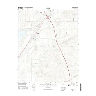
2016 Map of Savanna
USGS Topo · Published 2016About this map
Savanna and the surrounding Pittsburg County landscape are defined by a complex network of waterways and prominent ridges in this 2016 survey. The town site, positioned west of the major north-south Turnpike, retains its traditional street grid featuring Front St, Main St, and Choctaw Ave. The surrounding rural territory is marked by several significant reservoirs, including Brushy Peaceable Cr Site 31 Reservoir and its companion sites, which manage the flow of Peaceable Cr through the valley floors.
Find a feature on this map
70 named features on this map. Tap any name to fly to it.
Don’t see what you’re looking for? This feature index may not catch every label — zoom into the map to look around manually.
Map Details
Editions of this 2016 Savanna Map
This is the sole edition of this map. No revisions or reprints were ever made.
Other maps of this area

1898 · McAlester
USGS Topo · 1:125,000

1909 · Mc Alester
USGS Topo · 1:125,000

1950 · Mcalester
USGS Topo · 1:250,000

1962 · McAlester
USGS Topo · 1:250,000

1965 · McAlester
USGS Topo · 1:250,000
1966 · Haywood
USGS Topo · 1:24,000

1967 · Pittsburg
USGS Topo · 1:24,000

1967 · Krebs
USGS Topo · 1:24,000
1967 · Mc Alester
USGS Topo · 1:24,000
1967 · Mc Alester SW
USGS Topo · 1:24,000